
13 Ghost Towns In Kentucky [MAP]
Last Updated on August 26, 2022 by Urbex Underground
If you’re searching for ghost towns in Kentucky, we’ve got you covered! Below are 12 different ghost towns you can explore across the great state of Kentucky along with their status and exact GPS coordinates.
We rate ghost towns in Kentucky based on their status. Here’s how our system works:
- Abandoned: Is abandoned with ruins and structures in a decayed state. Great for urban explorers.
- Historic: Preservation efforts have been made and sometimes plaques installed. Great for everyone.
- Barren: Almost nothing remains of the town. Ideal for metal detectorists.
- Commercial: Is commercially owned with amenities, restaurants, and stores. Great for families.
- Semi-Abandoned: Abandoned areas with a small population in the area.
- Privately Owned: Tours might be available but not open to the general public.

History:
In 1902, a coal mining company established an area near Barthell, which became one of 18 mining camps. By the 1930s, the town had grown into a thriving company town where 100,000 tons of coal were extracted each month. By the 1950s, the mining industry had peaked, and the town’s prosperity waned.
The town was once home to hundreds of coal miners, and the area’s main street was a bustling trade center. However, as coal prices fell and the town’s economy sank, coal mining became a problem and the town was abandoned
What’s Left?
The coal camp sits on the Cumberland Plateau and features a moonshine still, reconstructed bathhouse, and displays of vintage automobiles.
2. Blue Heron
36.66897, -84.54765
Status: Abandoned

History:
The Blue Heron mining town was once a bustling center of the coal and lumber industry in Kentucky. The Stearns Coal and Lumber Company closed the town in 1962, and the structures were either razed or allowed to decay. But in the 1980s, the abandoned town was brought back to life as an outdoor museum.
What’s Left?
The abandoned community is a great day trip, and you can tour the mine by taking the Big South Fork Ghost Train. You can also take a tour of the abandoned buildings, which includes audio tours. This is one of the ghost towns in Kentucky that is a must-see. It is a fascinating place to visit, and it will give you a true sense of what life was like in this part of the country.
3. Paradise
37.26687, -86.98484
Status: Barren

History:
The town of Paradise is located in Muhlenberg County, Kentucky, about 10 miles east of Greenville. Originally known as Stom’s Landing, it was settled in the early nineteenth century. The town received its name from Leonard Stom, who owned a ferry.
The town’s post office opened on March 1, 1852, and operated until 1967. The town was frequently flooded by the Green River, which ultimately led to its demise.
What’s Left?
Today almost nothing remains of the town. Currently, the TVA operates a natural gas plant in the shadow of it’s old coal plant on the property.
4. Kyrock
37.26327, -86.2575
Status: Abandoned

History:
Kyrock was a company town built in 1918 by the Kentucky Rock Asphalt Company, hence ‘Kyrock’ was born. For the next 40 years the company and town would thrive, exporting hundreds of tons of asphalt for construction projects throughout the region. Kyrock asphalt even reached as far as Havana Cuba to pave their local streets.
Ultimately, higher costs to pave and a decrease in demand shuttered the town. The company was shut down in 1957 which led to the rapid decline of Kyrock.
What’s Left?
Today, all that’s left is several old foundations, the original water tower, and an old wining bridge over Pigeon Creek. While Kyrock isn’t one of the most exciting ghost towns in Kentucky, it’s still a cool place to check out if you’re nearby.
5. Bells Mine
37.5093, -88.02318
Status: Barren

History:
The Bells Mine Ghost Town in New Kentucky is a quaint, historic community located in Crittenden County, Kentucky.
The town was first settled in the early 1800s by settlers from Virginia, North Carolina and South Carolina, as well as English and German miners. In 1796, John Bells established the Bells coal company to exploit the local coal deposits. During the 1860s, a number of miners died in the area, and the town’s population dropped to a mere few hundred.
What’s Left?
Today nothing is left of Bells Mine, other than the memories and stories passed down from former residents. Its unknown if the mine is still accessible.
6. Golden Pond
36.7856, -88.02419
Status: Barren

History:
The Tennessee Valley Authority evacuated the residents in the late 1960s after two fires devastated the town. From that point, the town never really recovered. Recently, a memorial was unveiled depicting the abandoned community. The ghost town remains a symbol of the history of western Kentucky.
What’s Left?
Travelers can pull off of Route 68 to see the memorial sign of Golden Pond. Other than that, nothing remains.
7. Scuffletown
37.91957, -87.37326
Status: Barren

History:
In 1895, the Rand McNally Corporation published an atlas stating the town had a population of 71. The community also had a post office and school.
However, the area was badly damaged by the 1913 flood, and the post office closed permanently in January 1914. The town has remained almost entirely deserted ever since. Native Americans also inhabited the area before white settlers moved in.
What’s Left?
Today, the area around Scuffletown is known as Scuffletown Bottoms. Its a flat patch of land right on the edge of the Ohio River.
8. Packard
36.66445, -84.05548
Status: Barren

History:
The ghost town of Packard, Kentucky, was once a prosperous mining community in the late 1800s. During the 1930s, a manmade lake flooded the area and forced the residents to relocate.
The ghost town was named after a local school teacher named Amelia Packard. It once had a post office and railway station on the Louisville and Nashville Railroad. If you’re interested in more about the history of Packard, check out novanumismatics write-up on the town.
What’s Left?
Today, it is completely deserted and remains one of the most isolated ghost towns in Kentucky.
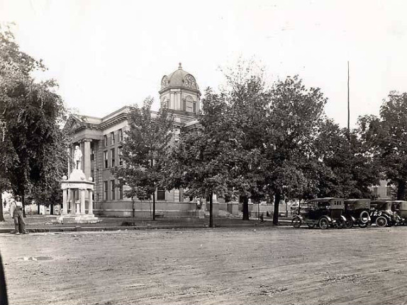
9. Blandville
36.94366, -88.96395
Status: Semi-Abandoned

History:
The history of Blandville goes back to the 1840s, when the town was incorporated. It was chosen to serve as the county seat for several decades, although some residents felt dissatisfied with the location. Blandville is on the Mississippi River, which is the most important shipping artery in the United States, and many residents wanted the county seat to be in Fort Jefferson, a fort built in the 1780s to protect the western border of the country.
What’s Left?
Today, Blandville has a population of 69, nice. Explorers can visit some of the historic buildings and find a few abandoned homes in the area. While this town is still inhabited, it very well could be a ghost town in the coming years.
10. Calloway Town
36.78341, -83.56324
Status: Underwater
History:
Calloway was established in 1837 by Isham Charles Wells and a small group of surveyors. Located right on the Tennesee River the town had fertile land, but suffered from flooding during heavy rain. The town dwindled during the 1850s and was ultimately deserted by 1870. In 1930 the land was flooded by the TVA Kentucky Lake Project, destroying any trace of the town.
What’s Left?
Today any remnants of the original Calloway Town are either underwater or completely gone.
11. Creelsboro
36.88506, -85.19745
Status: Semi-Abandoned

History:
Its small, rural community was founded in the early 1800s and became the center of life for the communities in and around the nearby Cumberland River bottoms. In the early 1900s, the arrival of steamboats made the town even more popular. With this newfound popularity, the town began to grow in size and thrive.
However the construction of modern highways in the 1930s shifted the public to automobiles, and the steamboats along with Creelsboro were largely forgotten.
What’s Left?
Today the town still has a small store, a church, and a handful of residents who live in the area to keep their town just barely alive.
12. Birmingham
36.90541, -88.21942
Status: Underwater

History:
Settled in 1849, Birmingham prospered after the Civil War by providing timer and stave mill services across the region. Over 200 people worked in Birmingham and by 1894 the town boasted five churches, two hotels, two blacksmith shops, and four general stores.
Sadly, when the TVA announced the construction of the Kentucky Dam in 1938, Birmingham was told their residents had to move. The town was flooded in 1942 leaving no trace of this historic community. Birmingham is one of many ghost towns in Kentucky that now rest underwater.
What’s Left?
Any trace of Birmingham is now sunken underwater. However, when water levels are low, old foundations can still be seen from Birmingham Point.
Go out and explore!
That concludes our list of ghost towns in Kentucky, but that doesn’t mean that’s all there is to find. Take the back roads, follow train tracks, and find some places for yourself. There are plenty of places I kept off this list so get out there and explore.
If you’re having trouble finding ghost towns be sure to check out our Ultimate Guide to Finding Abandoned Places, or explore other ghost towns across the country.


